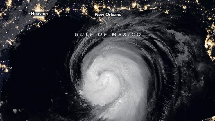
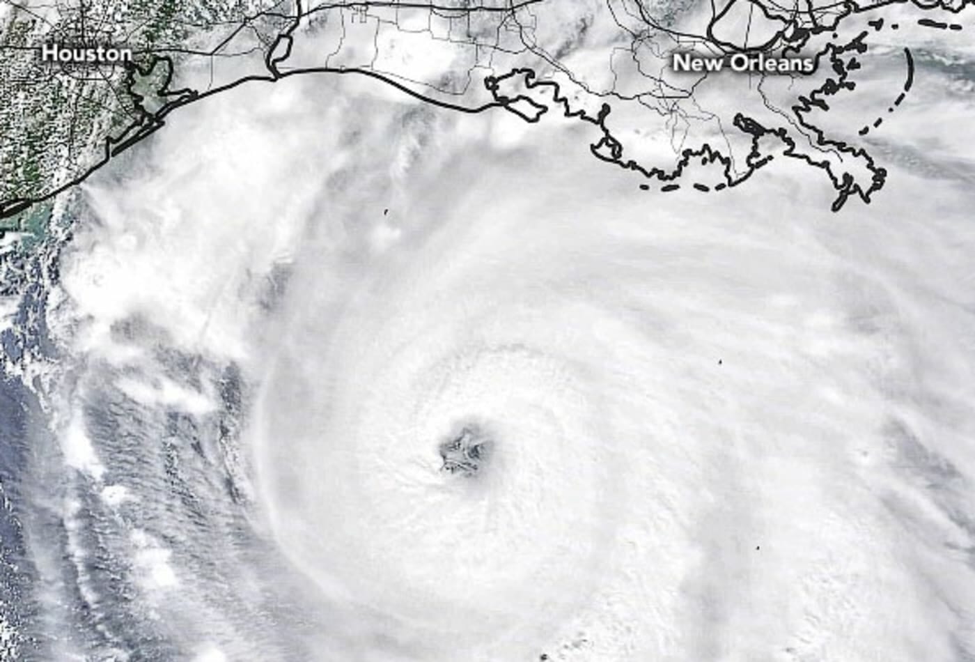
NASA has released images of Hurricane Laura in the south and of the California wildfires, which bring the scope of the weather events into focus.
And both are connected to climate change, according to Paul Ullrich, associate professor of regional and global climate modeling at the University of California Davis.
“Extreme weather events are perhaps the most potent message of the changes taking place in our climate system,” says Ullrich. “Both Hurricane Laura and the California wildfires are connected via a simple rule of thumb that seems to apply fairly generally in describing climate change: wet becomes wetter, dry becomes drier.”
“Warmer global temperatures driven by greenhouse gas emissions have clear downstream impacts on storm intensity, rainfall totals, soil drying, and risk of wildfire,” Ullrich says. “There is no doubt that warming Gulf of Mexico waters have made Hurricane Laura a larger and more intense system, and warmer air temperatures have allowed the storm to carry more moisture and drove up rainfall totals.”
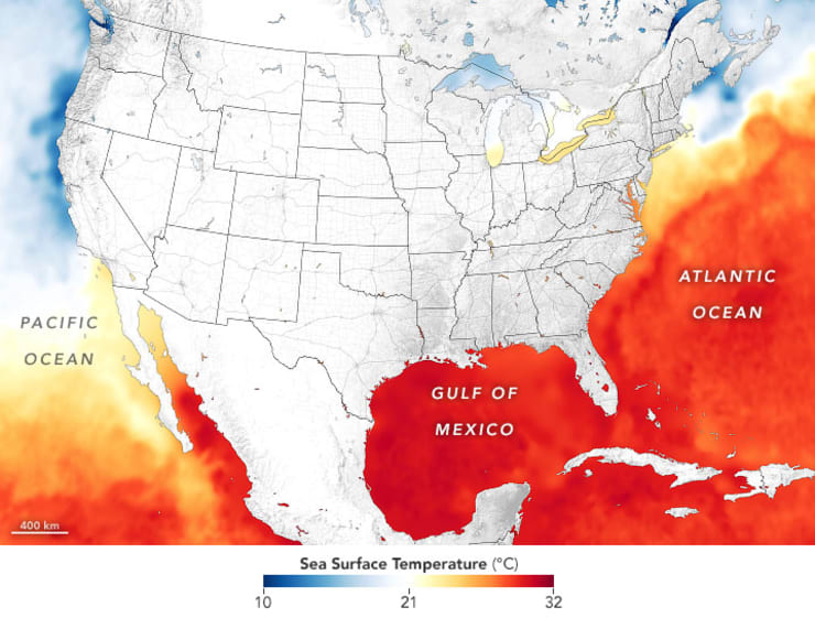
The NASA satellite image embedded below is a heat map of the ocean temperatures, where darker orange shows warmer temperatures.
The sea temperatures in the Gulf of Mexico “were running about one degree Celsius (1.8° Fahrenheit) above average,” according to a statement from NASA’s Earth Observatory. “Laura underwent a period of rapid intensification as it passed over the warm Gulf waters, with winds intensifying by 50 miles (80 kilometers) per hour over a 24-hour period.”
Ullrich says that human-driven climate change makes the rainfall worse: “As in the case of hurricanes Florence and Harvey, warming driven by human activity is likely responsible for 10%-50% more precipitation than an analogous storm without human activity.”
Meanwhile, as Louisiana is soaked, large swaths of northern California are burning.
“The California wildfires are the other side of the coin. These August wildfires have been driven by anomalous dryness associated with warmer temperatures, a recent intense heat wave, and an early Spring,” Ullrich says. “Although wildfires are a natural part of the landscape in California, the anomalous intensity and widespread devastation caused by these fires is a sign of a transition in the landscape as the rolling forests of northern California begin to look increasingly like the shrublands of southern California.”
Preliminary estimates of the costs of hurricane Laura are already in the billions. On Thursday, the Insurance Journal sited analyst predictions of an eventual cost of $25 billion.
“There is no doubt that billion-dollar weather disasters are becoming increasingly common. Areas of the U.S. that have historically experienced extreme weather will experience it in the future with increasing intensity,” Ullrich says.
“The way it is looking now is, if we don’t keep emissions in check … these (and other) extreme weather events are likely to worsen,” senior climate scientist with the Union of Concerned Scientists, Astrid Caldas, tells CNBC Make It.
“Unabated anthropogenic climate change will keep the potential for increased fire activity, and the trends observed in hurricanes are not likely to stop either. And we are not even mentioning extreme precipitation and other extreme weather events,” she says.